
Remember the era of writing long emails to a select group of family and friends, when we weren’t all quite as instantly connected? I did just that in January 2004 on a Hampshire College outdoors trip to New Zealand, which focused on sea kayaking and hiking. Below is a selection from the second group email I sent on January 23, 2004.
…we boarded a van for a new journey across the mountains to Nelson, an artistic northern center of the South Island and gateway to the adventurous activities of several national parks in the area. We stopped in the downtown city area of Nelson (near the sea) for a few hours and I was impressed by the incredibly cosmopolitan and independent spirit of the downtown. Street performers and art exhibitions were everywhere I could look and everyone walking along the main street seemed very happy to be there. The historical British influence was certainly more direct there, with “Trafalgar St” being Main Street and several bands sounding just like British pop. A few hours later we continued the journey in the van up a nozzle of the coast to the Abel Tasman National Park, likely one of NZ’s most popular national parks and especially crowded in the summer months. The next five days were to be spent in the park “tramping” (hiking) from north to south, opposite the traditional tourist track.
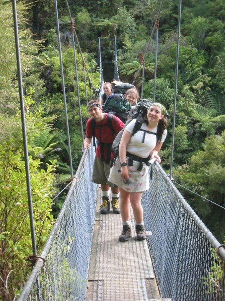
Snapping a photo of my classmates on a memorably narrow bridge along the trail.
I knew that we were in for something different and exciting as soon as the journey began the next morning. We boarded a water taxi (small boat) that was towed by a tractor down to the ocean shore, and then became self sufficient to drive us completely up the golden coast of the park. We passed high bluffs, rich surf, and several seal colonies en route to the top of the tourist track. The entire coast of the Tasman is a rich fine golden brown, unlike any other type of sand I had ever seen before. It was immensely refreshing to swim in after a hot day and beneficial just to look at when the route got sweaty. We began the tramping that day with a northerly loop around the park’s less-travelled northern quadrant. The track, or road, that we followed stayed quite close to the coast through several beaches and low sea forests. Eventually we reached a place called Seperation Point, which is one of the most northerly points of the South Island and had a quiet calmness to it as we gazed out from the rocks at the open, endless horizon to the north. The next day was a steeper incline up and down a large “hill” heading back to the coast but ultimately was no less rewarding. As we climbed the track, we could only see on the right side doughy bog-like marshland and water, and on the left was semi-Alpine green forest that snaked around back to the shore. Nonetheless it was very welcoming to get back to the water after hiking in the heat of the day. We stayed that night at a very family-oriented camp ground where at least 15 children biked through after dinner, asking us to help them with equipment for the hot scavenger hunt of the evening (which meant requesting books in a foriegn language, foriegn passports (!), and objects that could be used to make goods.) On the third day of tramping, we began to merge into the more commonly and frequently traversed coastal track. It was a LOT of hiking, at least 11 miles. The high point of that day was a coastal crossing that had to be done at least 1 1/2 hours before high tide otherwise it would flood. We ended up crossing in water anyway, which felt like a clamming trip in the bogs of the shore (and indeed we ended up stepping on several hundred clam shells.) It was a great delight to finally reach the campsite that day, even if it was raining. The next day brought another, shorter, estuary crossing and lots more of coastal beach scenery that also managed to mix in with the forest. I was intrigued by the dimensions and dynamics of a bridge that could only hold five people one way at a time and was swinging at least 50 feet above a river; the trail itself quickly plunged back down to semi-coastal level. That night, it was again a delight to be able to sleep right on the beach and be rocked to sleep by the energetic waves. The final day of tramping felt like coming full circle. The trail continued back down to where we had been before, and this time it was finally at a level gradient along the water. We saw endless blue and much boat traffic navigating the seas to the left of us. Eventually five short pedestrian bridges signalled the end of the line. Many of us had blisters from the tramping experience but I highly doubt that anyone was in bad spirits cause of the energy and faith of doing things together as a team.
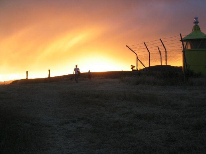
An especially memorable sunset earlier in the New Zealand trip.
The taxi returned to drive us 250 miles through snakey mountains and dramatic oceansides down the west coast of New Zealand. We saw more farmlands, wineries and even a whitewater rafting river before the road came alongside the ocean again. This time we were bordering the Tasman Sea, but the waves had all the energy of good Pacific hits. We stopped briefly at a tourist attraction called the Pancake Rocks, where large amounts of rocks have been so windswept and weather beaten, they have gradually become part of the sea, and eroded down into pancake shapes. Meanwhile the land surrounding them has started to sprout blowholes where water sneaks in to a small crevasse at high tide and then erupts back up as if part of a geyser. We continued down the coastal road to Greymouth, the West Coast’s hub city, for a two day stay. The locals call the west coast area New Zealand’s “wild west” and it was somewhat painfully obivous to see why. Greymouth was somewhat creepy and well past its prime, perhaps like an abandoned mine town might be in the Western United States. It only had a small town center that closed up shop every night at 5pm and no one seemed to go out of doors after then, even though the town is positioned at the mouth of a gusty river that guarantees great coastal views. The next day we found something to write home about in the town by participating in a “caveing” experience through an adventure company. We put on wetsuits once again and were bussed up to the hills to a deep subterranean cave. A guide led us through an experience of rafting by glowworm light, swimming in COLD water and hiking along different rocks. It was fun to see, but not unique, and I felt like the group was a little cast aside when two following tour groups came into the cave to do the exact same activities.
We left Greymouth via train on the spectacular TransScenic railway that is the most efficent connection between the East and West coasts of the central part of the South Island. It was a special thrill to sit back and feel the steam machine climb up the mountains to Arthur’s Pass, a small township and national park nestled right in the middle of the Southern Alps. The peaks and some of the villiages look almost identical to Switzerland, so the resemblance from place to place was very overt, and resonant. We spent one night in Arthur’s Pass, which is exactly like a charming Swiss villiage, only nestled here in the middle of the South Island instead. A small array of services and crafts line the main street, nestled in a ridge between high peaks with names like Avalanche Peak and Rollaston Pass. Disappearances of hikers are sadly not that uncommon there. The town itself had a pleasant character, with many natural amenities including a 50 foot (or so) tall waterfall that I saw on a short hiking experience today. We continued the journey on the train this afternoon, finishing the route back to Christchurch along mountain peaks, farmlands, and flat plains bordered by icey rivers before hitting the metropolitan area of the city for one more time. And indeed it is down to the last hurrah, as our journey home begins tomorrow (the 24th) at 1:30pm, but due to the “magic” of the International Dateline, will only conclude early morning of the 25th. It will certainly be a jarring temparature change, and probably the longest day ever (48 hours) for several of us. Then will get to have less than 24 hours back at home before returning to Hampshire, so hope the transition isn’t too abrupt…
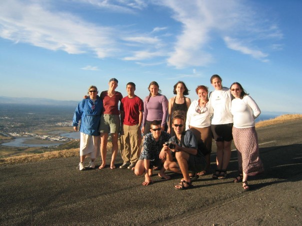
Our intrepid group of travelers.
