Martha's Vineyard, Massachusetts, Traveling

Summer Solstice, Summer Sights

it’s become a source of irritation to me that it seems increasingly difficult to get back in the blogging routine. Over the past year and a half I have published TWO posts. And yet, I’m still online constantly, going about my daily digital routines.

But what if I actually sat down and wrote something? On this blog that I continue to pay for? Imagine that.

So, this morning’s heavy rain on Martha’s Vineyard and concurrent status as the first official day of summer seems to be a good time to actually come back to the blog.

But what to write about? In my present full-time islander iteration, I seem to have mastered the art of short off-island trips. Last weekend was the last opportunity for awhile, and this time my sights turned to northern New England, as in New Hampshire and Vermont.

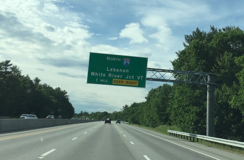
There was something familiar and pleasant about seeing the signs for roads I grew up with while making that same drive with family. The journey to our usual destination in Vermont, in particular, is so familiar that I could create a checklist of where to stop and when. But for this occasion I decided to change it up and go “the other way” all the way north along I-93 through Franconia Notch, ultimately to the road’s terminus in St. Johnsbury, Vermont, where i would be spending the night just north of my intended destination.

There was also something familiar and pleasant about simply having an OFF-ISLAND DRIVING EXPERIENCE where one could go higher than 45 MPH and not have the thought of a ticket go into one’s mind. The lack of geographic limitation – if I had more time I may well have driven on to Canada, just 50 more miles north – also factored into the appeal.

The I-93 route has always had a feeling of being more mysterious and dynamic than the blander I-89 route across New Hampshire. The sensation reaches its apex in the Franconia Notch Parkway, which “required Congress to pass a special amendment to the standards applied across the rest of the U.S. interstate system” as briefly described here, and was originally not even signed as part of I-93. The mystical feel is also evident in a different way at night, when you can’t even see the mountain tops, and I recall feeling that way on my previous evening trip through the notch, near the end of 2015.

This particular pass through also made me notice how the parkway is a rare (for New England) evocation of Southwest and West Coast driving experiences, with the Virgin River Gorge in Arizona being perhaps a particularly close equivalent, which I’ve now seen for myself but had no idea of on childhood trips through.

And then the road widens out again and its onward north into Vermont. The Green Mountain State has always felt welcoming to me, though it had been slightly over a year and half since i was last in the area. As with any state lines, there is a noticeable change in “feel” from the start, and makes me recall the opposite “back to real life” feel of re-entering Massachusetts, which I experienced again on this weekend’s trip.

Once in St. Johnsbury, I wrote on Facebook later to close out the day:

Back in St. Johnsbury Vermont for one night only, celebrating 30 years of coming to the Northeast Kingdom, recalling two separate instances of considering moving here.

I didn’t realize until today that this Father’s Day weekend trip also honors the memory of a short trip here in 1990 with my dad, possibly also on Father’s Day weekend, when we caught the then-new release DICK TRACY at this very cinema, and friends back at Karme Choling were very interested to hear how the movie was.

And the mix of nostalgia and acknowledgment of the present seems a good way to wrap up this reflection exercise and notation for today.


Standard
Traveling

On the Road Again – and Again

In my current travel mode I’ve decided to make an effort to blog more. So I wrote this a few days ago attempting to recap the initial driving on the road experience of this summer.

I spend a lot of time looking forward to traveling, but I don’t spend a lot of time reflecting on traveling. But maybe that will change with this summer on the road. I’m writing this from almost as far south as one can go in the USA, just 100 miles or so from Miami and the end of the road.

It was a fun challenge to come down here from Michigan and do the trip almost entirely on the same road, Interstate 75, which extends up the middle-center of the country from just outside Miami to the Canadian border at Sault Saint Marie, Michigan. I, of course, know the road particularly well in the Detroit area, and had encountered portions of its Florida path before.

This time, the decision to travel southbound included significant stretches of Kentucky and Tennessee, two states I’d never set foot in before, and (in going through them it is) now bringing my remaining states yet to visit to just four, with the lower 48 set to be clinched next month. I expected to see more pastoral farmland than I did in Kentucky, and I wished I’d had more time to explore the surroundings of the area. Nonetheless, both Kentucky and Tennessee offered a surprising (to the visitor) range of pastoral mountain scenery, similar to what I know from the northern reaches of back home in New England. (It also served as a reminder that my car is not the best one for mountain environments.)

Road scene captured during Lexington, Kentucky area rush hour.

Road scene captured during Lexington, Kentucky area rush hour.

This rugged environment continued farther south into Georgia than I expected before abruptly giving way to the Atlanta area sprawl. Well, maybe the gradual widening of the highway was a clue, but the sudden merging of two major highways brought traffic to a full stop. As the traffic inched forward again, the exits revealed a veritable golden highway of tourist attractions. Carter Center! Turner Center! MLK Jr National Historic Site! Downtown Atlanta itself! If I’d had more time, I would have arranged to explore a few of those places. But it will have to wait for some other opportunity.

As for Florida, the state is “open for business” as the sign at its welcome center proudly proclaims. In a cute touch, they even offered free orange juice at the center, with an attendant cheerfully handing the beverage out (in a small cup) to anyone who wanted it. I needed the fortification when, an hour or so later, the clear skies abruptly gave way to rain so heavy it was like a flash flood. The deluge continued for maybe 10-15 minutes and I turned off the stereo to concentrate solely on navigation. In this case I was grateful for my small car and easy maneuvering from the slower to middle lane. It was a relief to see the rain go away and I needed to pull off at the next big town, Gainesville, to recover from the excitement.

It was rush hour in Gainesville and the stop served as a quick redux of a city I wouldn’t have expected to get to know over the past few years; this brief stop was my third time there in the past three months. The main commercial area near the highway has undergone modest to sizable changes since the first time I was there in 2012, with increasing emphasis on sprawl and congestion, which looks unlikely to change anytime soon. Because of the heavy traffic I was unable to look for a “cheap” gas price and had to settle for the currently high $2.34 per gallon, which was clearly an overage from what other stations were offering.

The process of making a long trip quickly and succinctly reminded me of the value of Intentional Traveling, where there is value in taking a quick look at a map before you get underway and deciding on a tentative outline of where and how frequently to stop on the way to your destination. I will be following that mode as summer on the road continues.

Standard
Massachusetts, Traveling

The Road Geek Returns

US 101

With a familiar highway in California

This week has seen a sudden return to my “old habits” of geeking out about road related matters, specifically road signs. I’d love to know when and where this attraction originated… but it’s been a fascination as long as I can remember, most notably with a long-running childhood project of drawing exit signs.

In this regard it’s exciting to live in Michigan, with its oh-so-slightly different standards of signage to the rest of the US – if anything, more close to European standards than you find elsewhere in this country. Some examples of this include the angular directional signs that are sometimes seen on highways going in different directions (one good example being here on the way into Ann Arbor) and a general penchant for smaller, angular signs that say what they need to say in a more compact orientation than one might find in another state. Finally, those same signs often don’t indicate the cardinal direction of the route, as I memorably captured in the photo below at an earlier point this year.

IMG_1222

BUT, all of this interest in signs somehow generated itself from growing up in Massachusetts, which has its own infamous system of highways that were designed one way and then went another, courtesy of the freeway revolts of the 1970’s and a (rightly) growing sentiment that the region shouldn’t be decimated by a ring of urban highways tearing apart neighborhoods.

The highway to my hometown in Massachusetts

The highway to my hometown in Massachusetts

So this renewed fascination has taken me onto a few highway forums, most notably this one, from which I learned that Massachusetts plans to belatedly convert all of its highway exits to mile-marker based, as opposed to sequential, over the next year or so.

I feel like there should be more to say about my home state catching up to the rest of the country in this regard. But … it’s all well and good. And I’ll believe it when I see it.

Standard